 Interactive
Map Wall
Interactive
Map WallInteractive
Map Wall
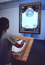
Re-Cartographer Richard Pell has taken the form and imagery from the historic-romantic Frick Park map and extended its symbology, form and content into the 21st century. The re-mapping provides the viewer with a point of access into a scientifically and aesthetically informed data base on the public realm of the Nine Mile Run Valley. Juxtaposing the (private) intimacy of paper maps with the potential for public access and use of electronic information, the wall projects the form of the Nine Mile Run team¹s final report in the year 2000.
Richard Pell:
Design, Implementation
Herb Gilliland: Graphics and Design Support
Richard Pell, Tim Collins: Content Development
Bob Bingham: Voiceover
 |
 |
|
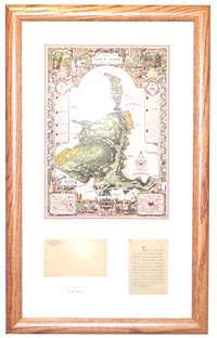
(left)
Original Frick Map
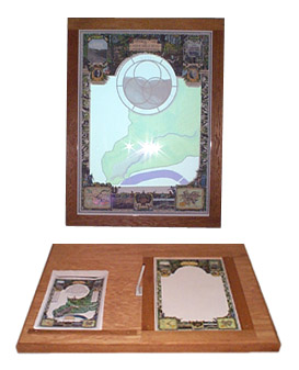
|
(right)
Interactive Map
|